Developing a Baseline Assessment

While gathering current baseline data together in one place is useful for data and planning needs, the real strength of a baseline assessment is in its ability to create a shared understanding of current conditions in the watershed, supplying stakeholders with access to a similar base of knowledge for decision-making.
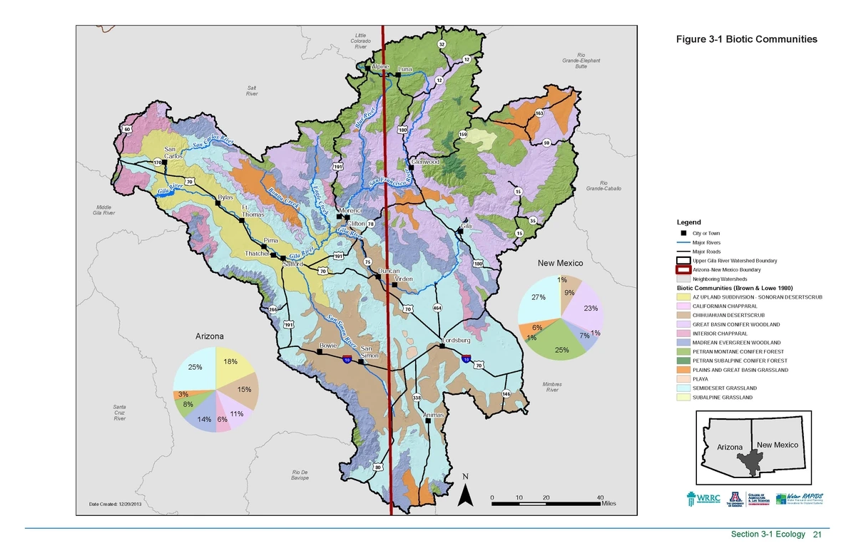
The Atlas for the Upper Gila Watershed is a compilation of GIS analysis, historical data, and critical thought. Interviews and science coordination within the watershed was necessary for this information to be relevant and accurate. The result of an iterative process, regular stakeholder engagement was required to thoroughly capture the conditions within the watershed.
Download the entire Atlas HERE.
You can find our tutorial for leading a watershed baseline assessment HERE.
Results from the Upper Gila Watershed
Major current and future issues identified by regional experts and water users:
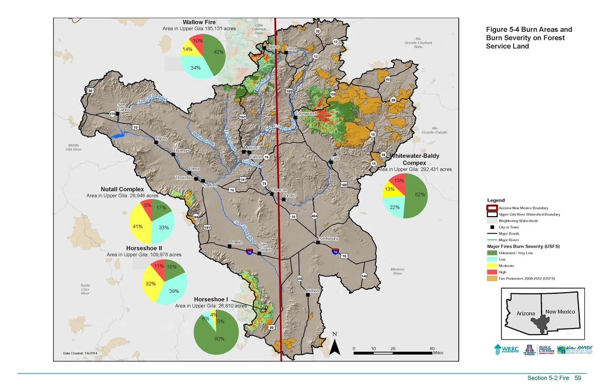
Increase in areas impacted by fire
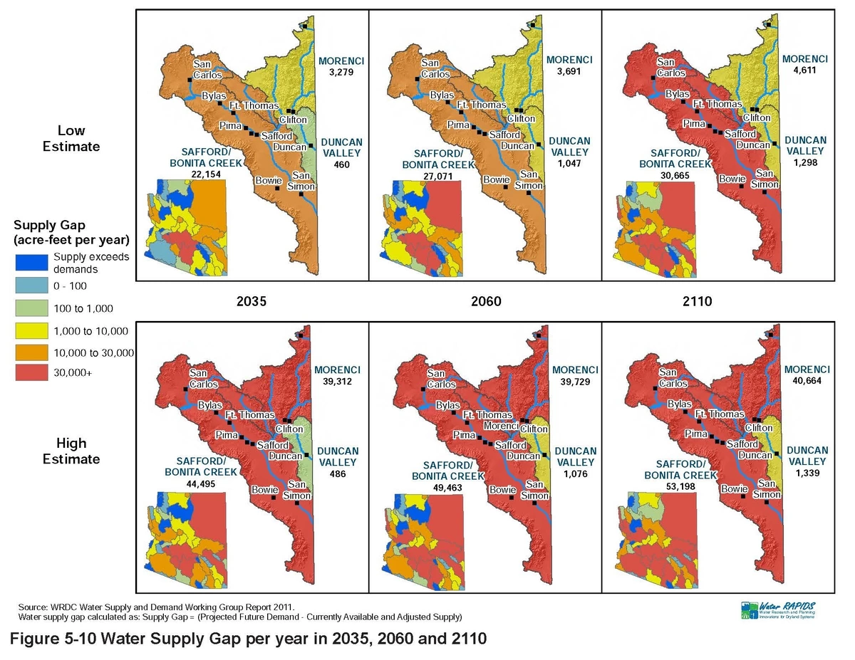
Need for planning to secure water supplies to meet future demands
Impacts from changing precipitation patterns and drought
Population growth and increase in wells
Lack of data for many key resources, including groundwater and springs
Mapping for this phase of watershed planning was an effective way of displaying information and presenting water resources to the community:


