
Photo Journal: A Visit to the Upper Colorado River Basin
Last week, WRRC staff member Jessie Hampton visited family in rural southwestern Colorado. She stayed along Cebolla Creek, which flows down to meet the Gunnison River in Blue Mesa Reservoir, one of three reservoirs that make up the Curecanti Unit of the Colorado River Storage Project. Local ranchers use their water rights on Cebolla Creek to irrigate hay meadows. Jessie took photos of places she visited on her trip to showcase different types of water usage and management in the area.
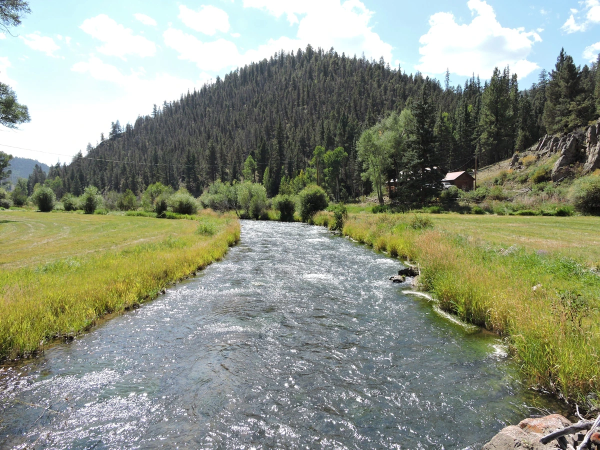
Photo 1: Cebolla Creek is named for the wild onions that grow along it; cebolla means onion in Spanish. The high elevation (nearly 9,000 ft) means that the water flows fresh and cold, fed by mountain streams and snowmelt. The meadows on either side of the river in this shot have already been hayed.
Jessie Hampton, Gunnison County, Colorado
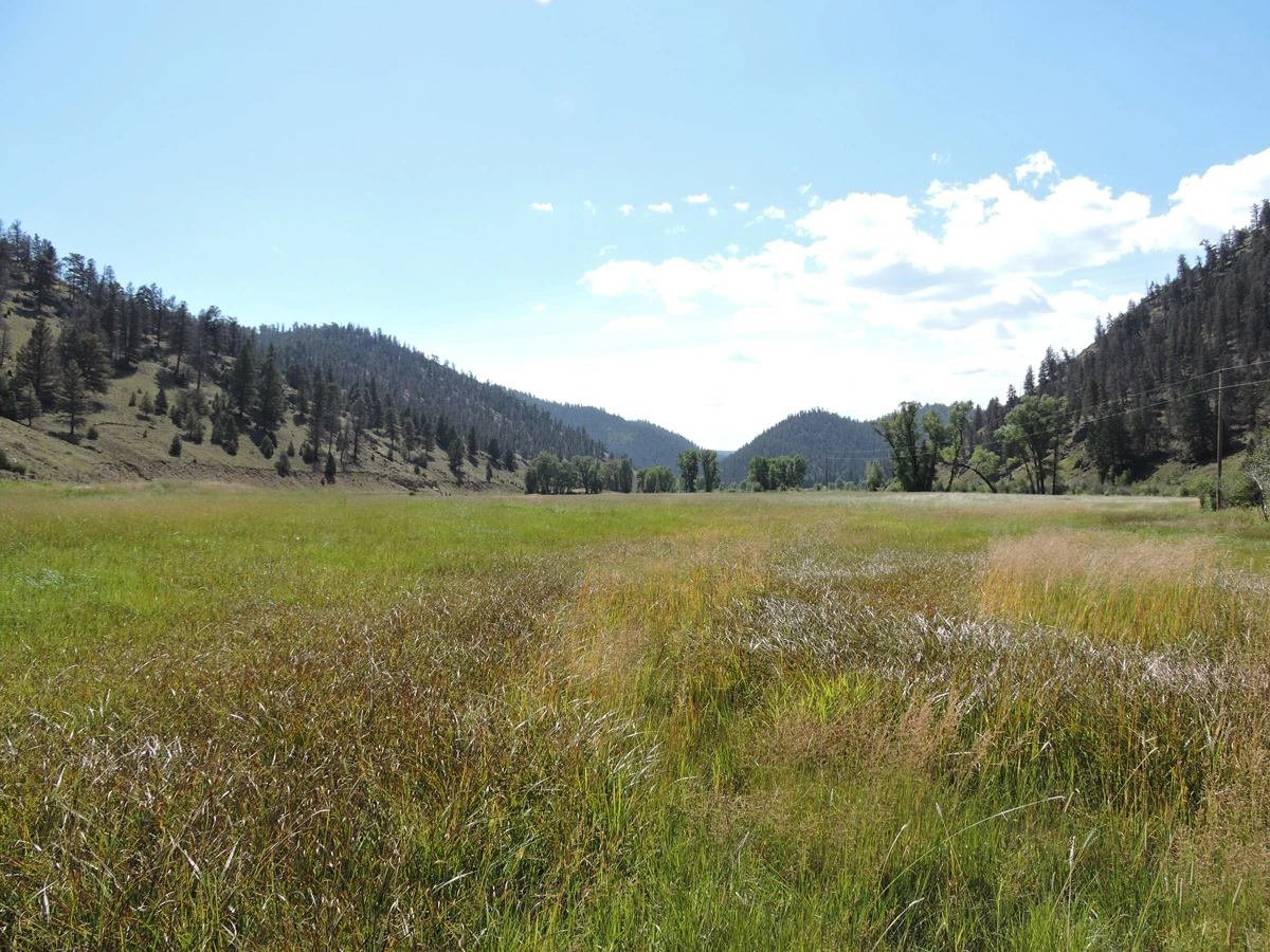
Photo 2: This large meadow is waiting to be hayed. The irrigation has been turned off and sunny weather has dried everything out enough to permit haying equipment to drive on it without getting stuck.
Jessie Hampton, Gunnison County, Colorado
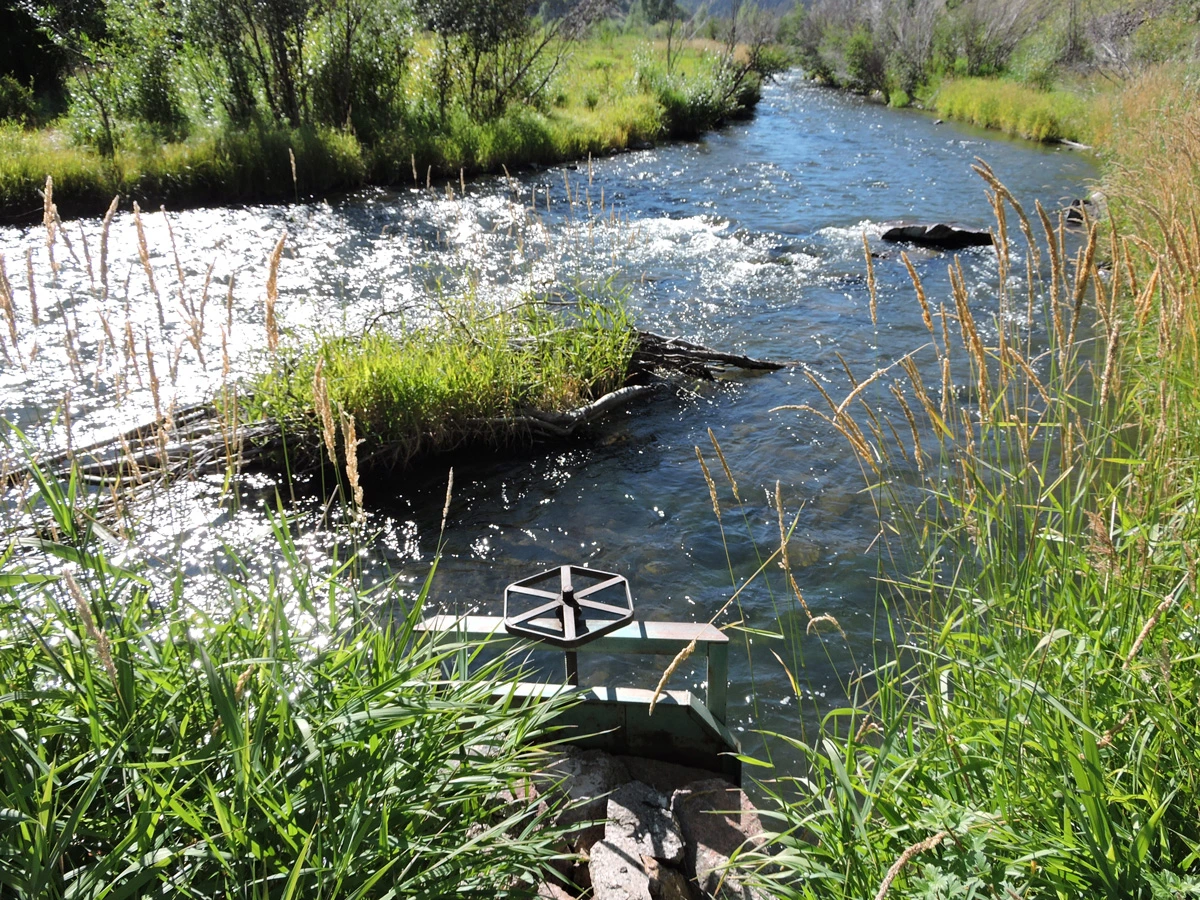
Photo 3: Cebolla Creek curves away to the left while a portion of the water is diverted by a small rock dam into the headgate of an irrigation ditch (center).
Jessie Hampton, Gunnison County, Colorado
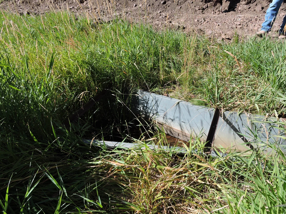
Photo 4: In a setup typical for the area, a metal flume set into the irrigation ditch allows ranchers to monitor water levels and adjust as necessary by opening or closing the headgate.
Jessie Hampton, Gunnison County, Colorado
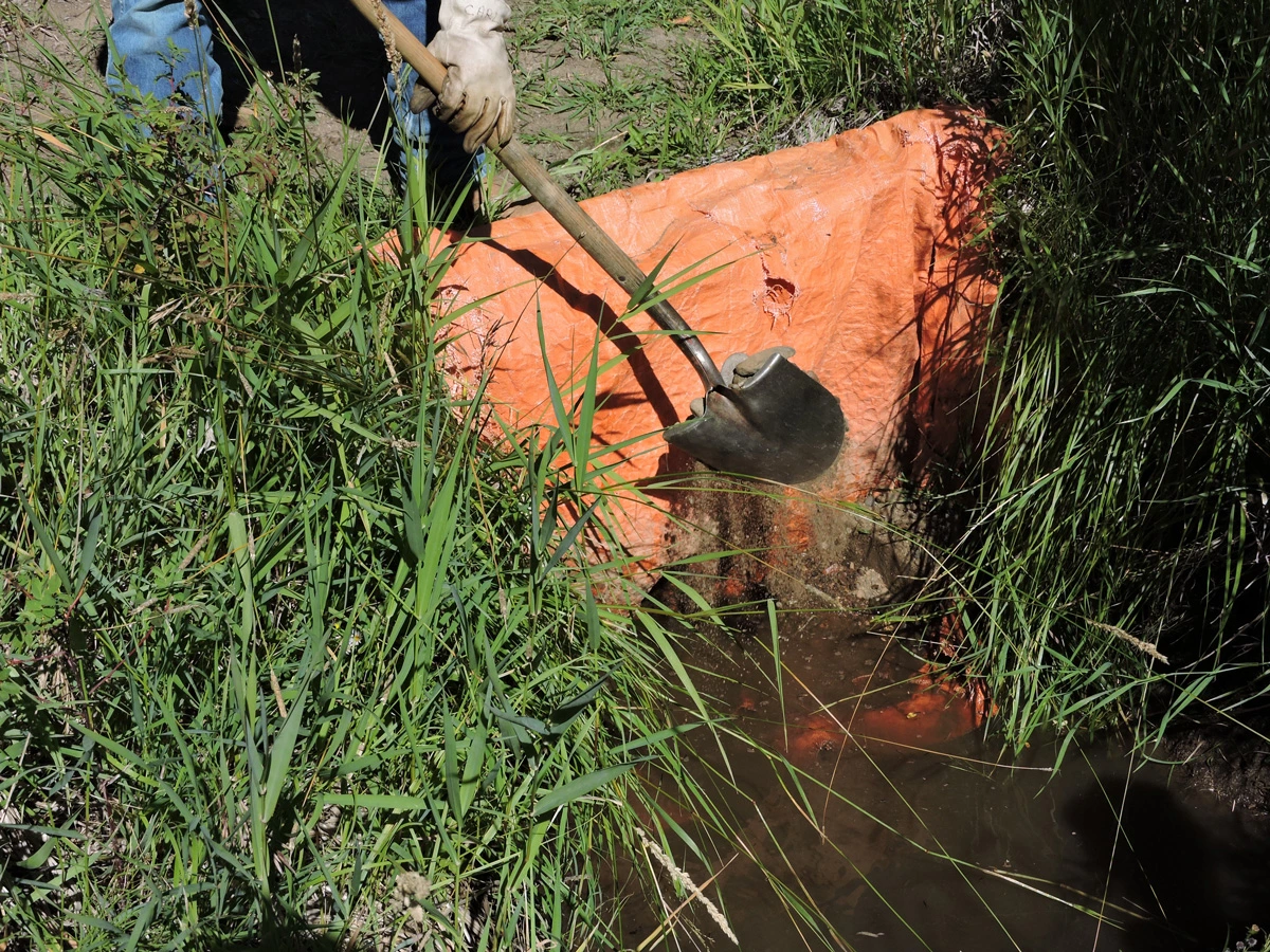
Photo 5: The end of summer means it’s time to turn off the irrigation and start cutting the hay. Headgates are shut off and some ditches are further sealed with plastic sheeting, held down with good old-fashioned dirt and rocks, to keep the water in the river and out of the meadows.
Jessie Hampton, Gunnison County, Colorado
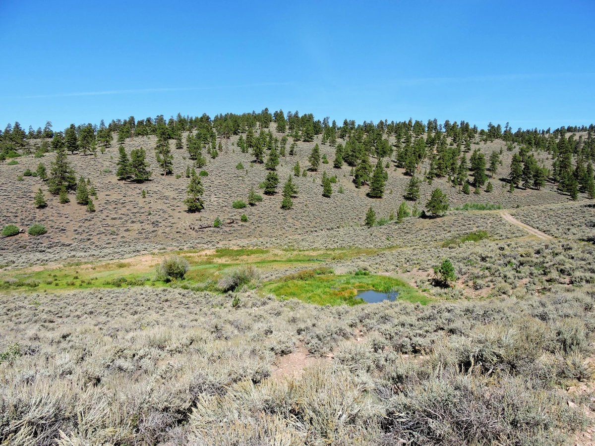
Photo 6: A high country spring feeds a stock pond and spring box, used by wildlife and cattle. The landscape is dominated by sagebrush and ponderosa pines.
Jessie Hampton, Gunnison County, Colorado
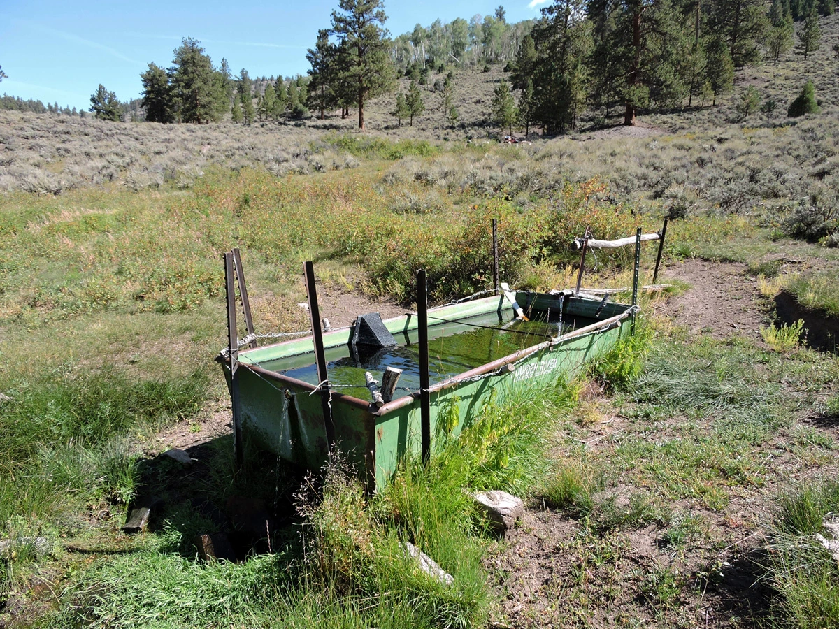
Photo 7: This spring box allows for both inflow and outflow, keeping the water relatively clean. Fence posts and barbed wire prevent cattle from tipping it over, while still allowing them to safely drink. A wildlife ramp affixed to one side gives smaller animals a way to escape, should they fall in.
Jessie Hampton, Gunnison County, Colorado
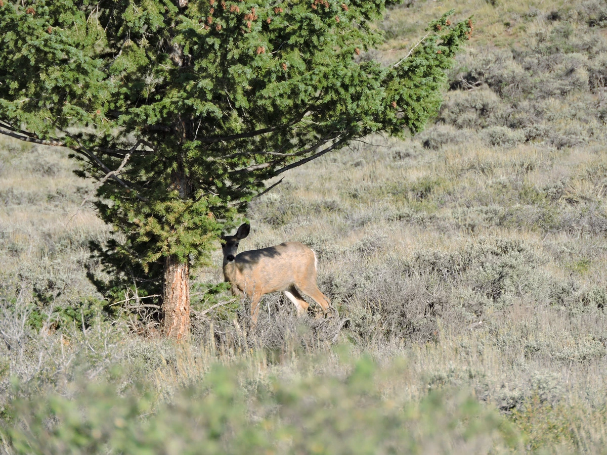
Photo 8: The mountains are home to many types of wildlife, including this mule deer doe. Although many people think of the Rocky Mountains as being green and lush, this ecosystem is actually a high-elevation desert.
Jessie Hampton, Gunnison County, Colorado
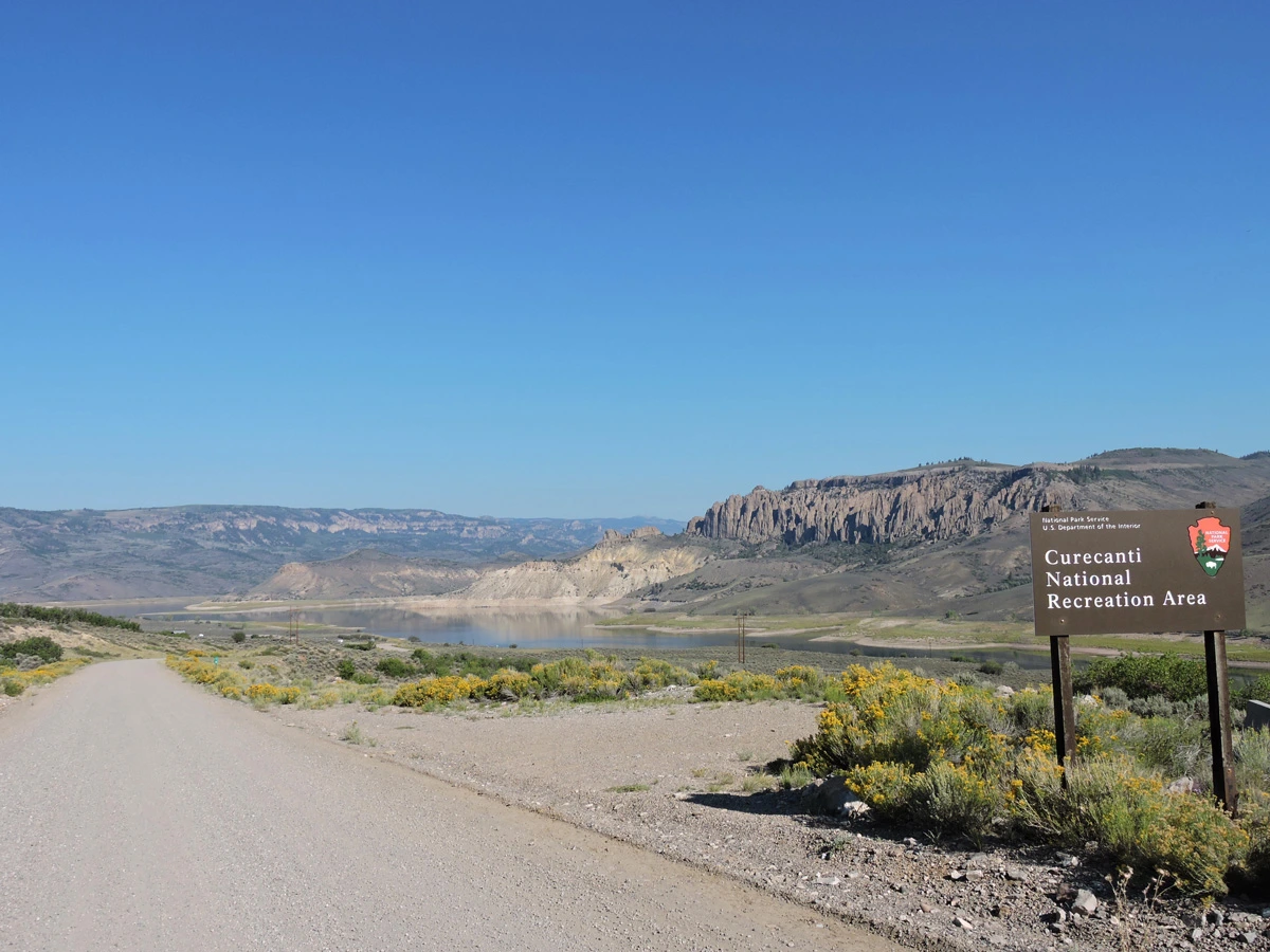
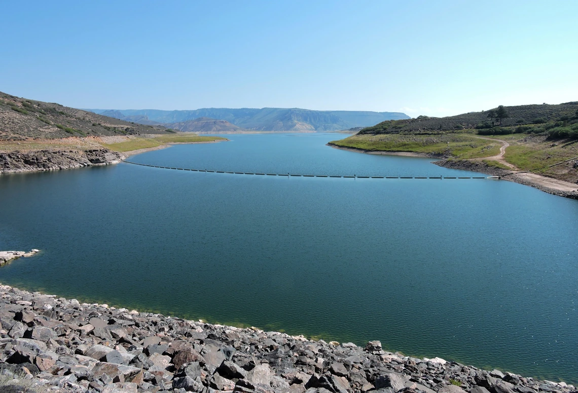
Photo 9: Looking down on Blue Mesa Reservoir, it is easy to see that the water levels are low. Note the stark color difference between the high-water mark and the surrounding land.
Jessie Hampton, Gunnison County, Colorado
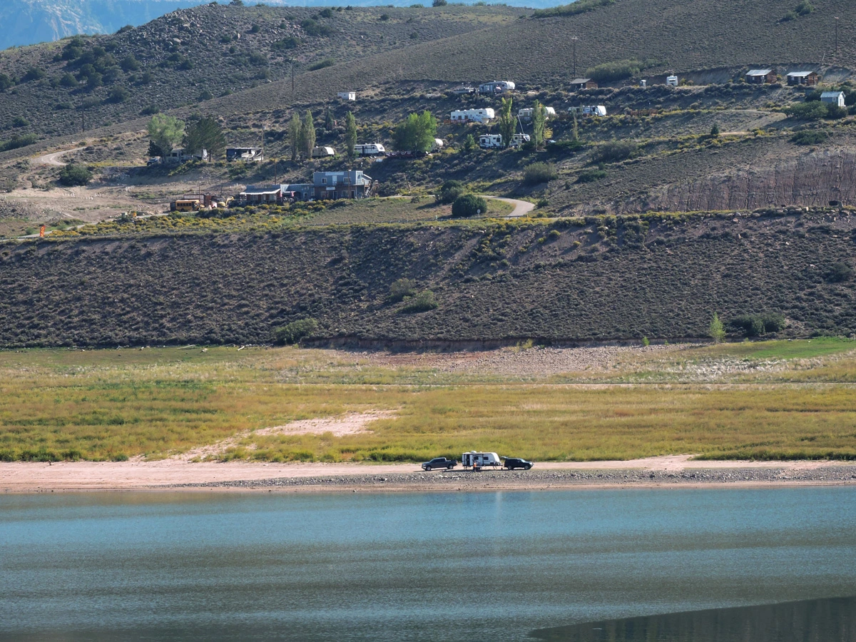
Photo 10: Some folks camping near the water’s edge provide a sense of scale. The high-water mark is far behind them, at the edge of the green grass.
Jessie Hampton, Gunnison County, Colorado
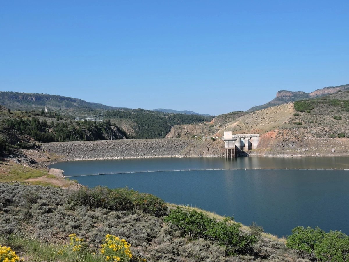
Photo 11: The upstream side of Blue Mesa Dam may not look like much, but it marks the beginning of the majestic Black Canyon of the Gunnison below.
Jessie Hampton, Gunnison County, Colorado
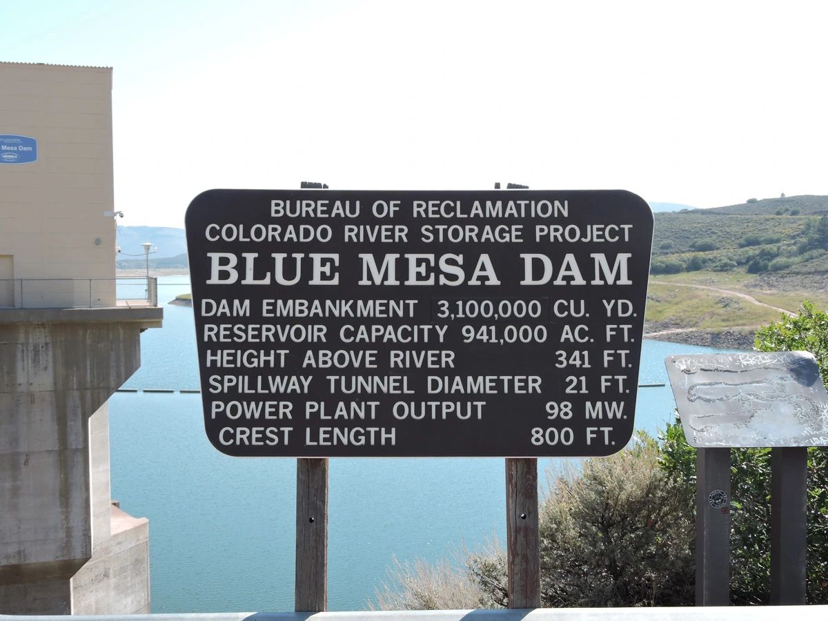
Photo 12: There is a small parking area on top of the dam, where the Bureau of Reclamation has provided informational signage for visitors.
Jessie Hampton, Gunnison County, Colorado
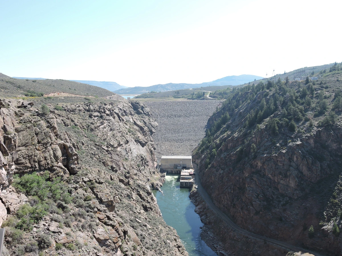
Photo 13: Downstream, an overlook provides a clear view of the base of the dam, where there is a power plant and an overflow spillway.
Jessie Hampton, Gunnison County, Colorado
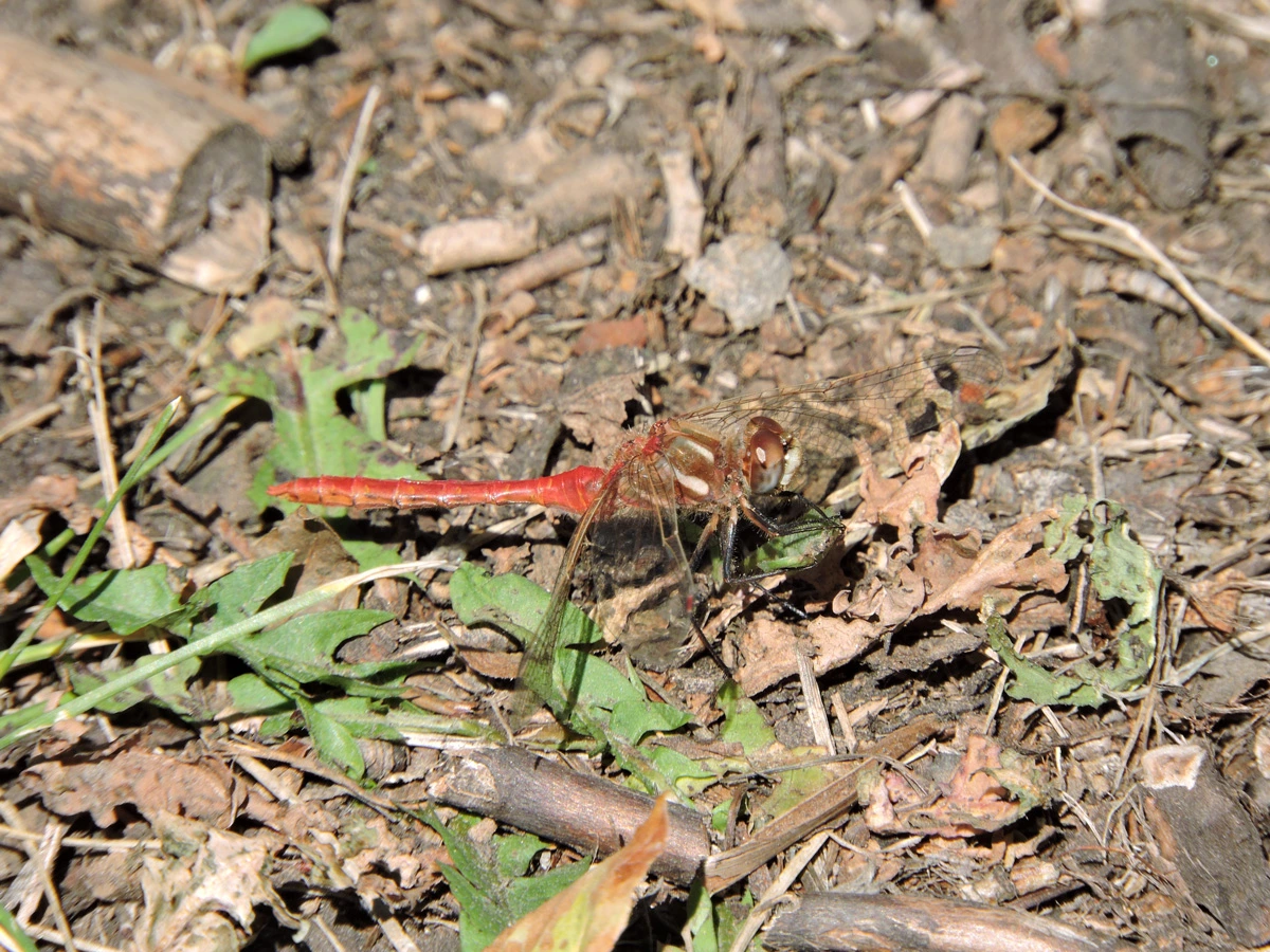
Photo 14: Dragonflies and other aquatic insects are important members of the riparian ecosystem.
Jessie Hampton, Gunnison County, Colorado
Photo 15: Final thoughts from Jessie
Jessie Hampton, Gunnison County, Colorado
Final thoughts from Jessie
I have been visiting the ranch on Cebolla Creek for nearly 30 years. I have watched the water in Blue Mesa Reservoir rise and fall in accordance with the seasons, snowpack, rainfall, and demand for water. I have seen Cebolla Creek flow low enough to splash across in rubber boots and flood high enough to wash out bridges. While I am relatively new to the WRRC, I am already gaining a deeper understanding of how those high-elevation Upper Basin water levels affect life downstream. The ongoing drought in the southwest presents a host of challenges for water users throughout the Colorado River Basin. Is it possible to do more with less? How can we cut back, and whose water rights will be cut first? How do we collaborate to find solutions that cross state borders? These are difficult questions with no easy answers. I hope to bring my connections with the Upper Basin into my work with the WRRC, just as I brought newfound appreciation for the complexity of Colorado River water issues to my recent visit to beautiful Cebolla Creek.
Banner Image: The view from Blue Mesa Dam