
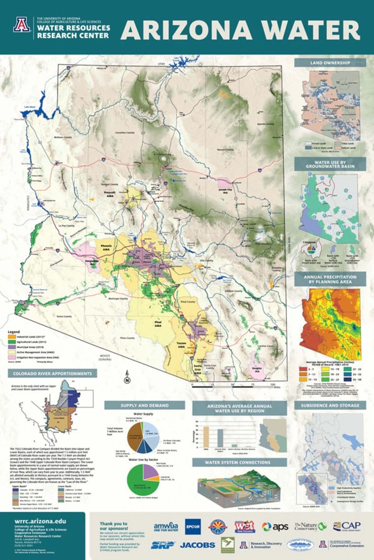
The Water Resources Research Center Arizona Water Map Poster is the latest in our series of reliable and concise visual representations of Arizona's water resources. This, the fourth edition of the map is the product of a design and review process that engaged stakeholders from across regions and sectors. The new map reflects the current state of water resources in Arizona, as well as a culture of management and planning unique to the state.
Get your Poster!
A free PDF of the poster is available for download here. Otherwise you can pay for printed copies.
- Cost of Poster: $12.00 plus applicable tax and shipping
- Poster Size: 24" x 36"
- Rolled posters (no creases) can be picked up or delivered by Fed Ex
- Folded posters (will have creases) can be picked up or be delivered by the US Postal Service
Notable updates and changes
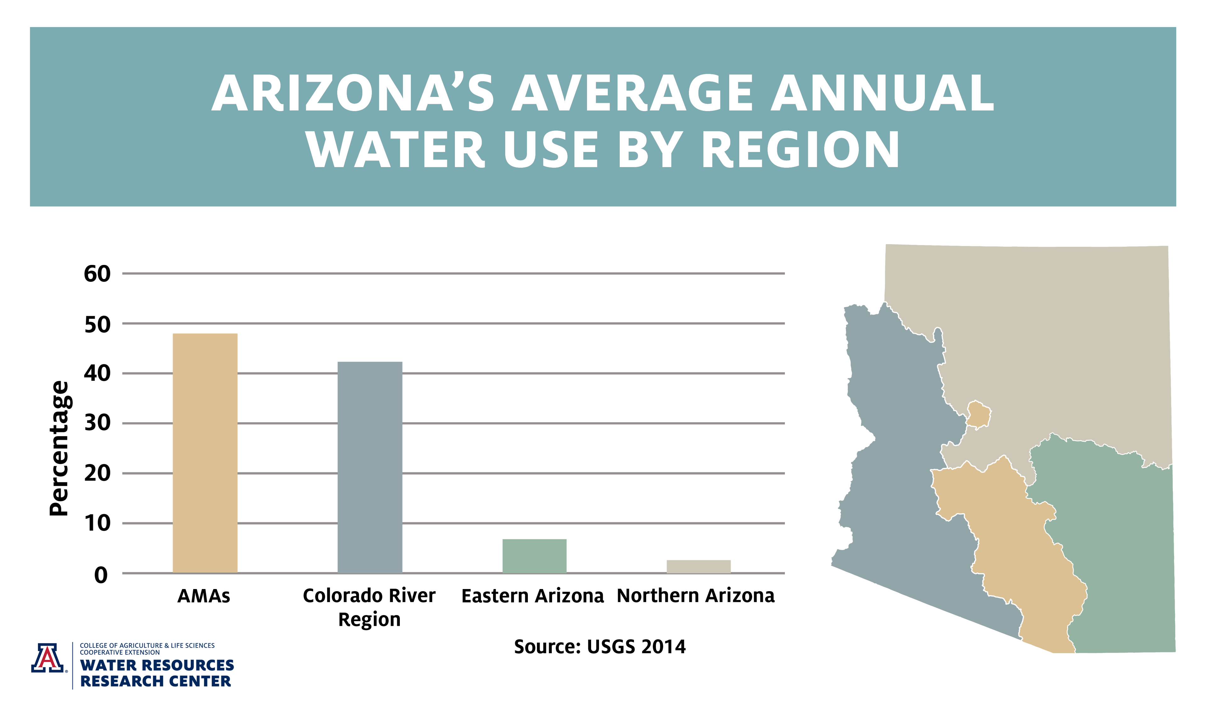
- Stronger emphasis on water supply and demand among different water using sectors and regions
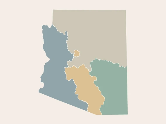
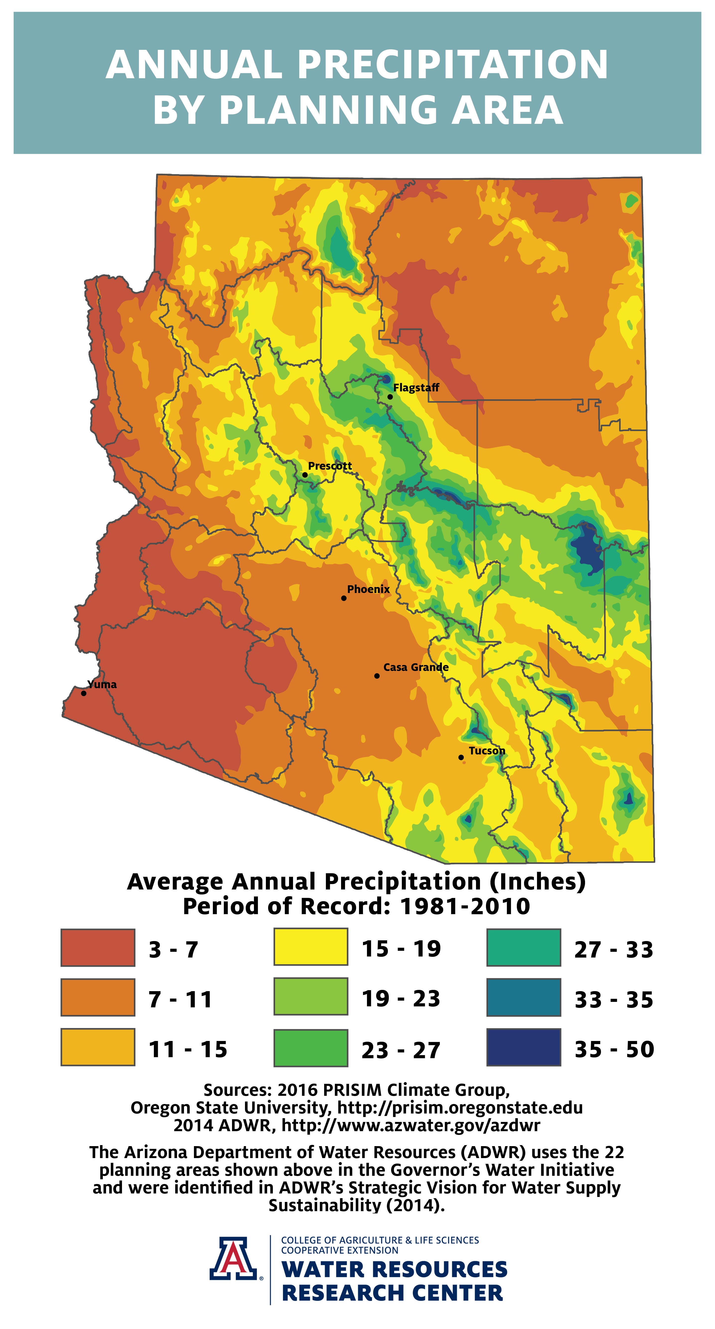
- Inclusion of ADWR’s 22 planning areas
- Updated data to reflect current knowledge
- Updated appearance to reflects modern design technique
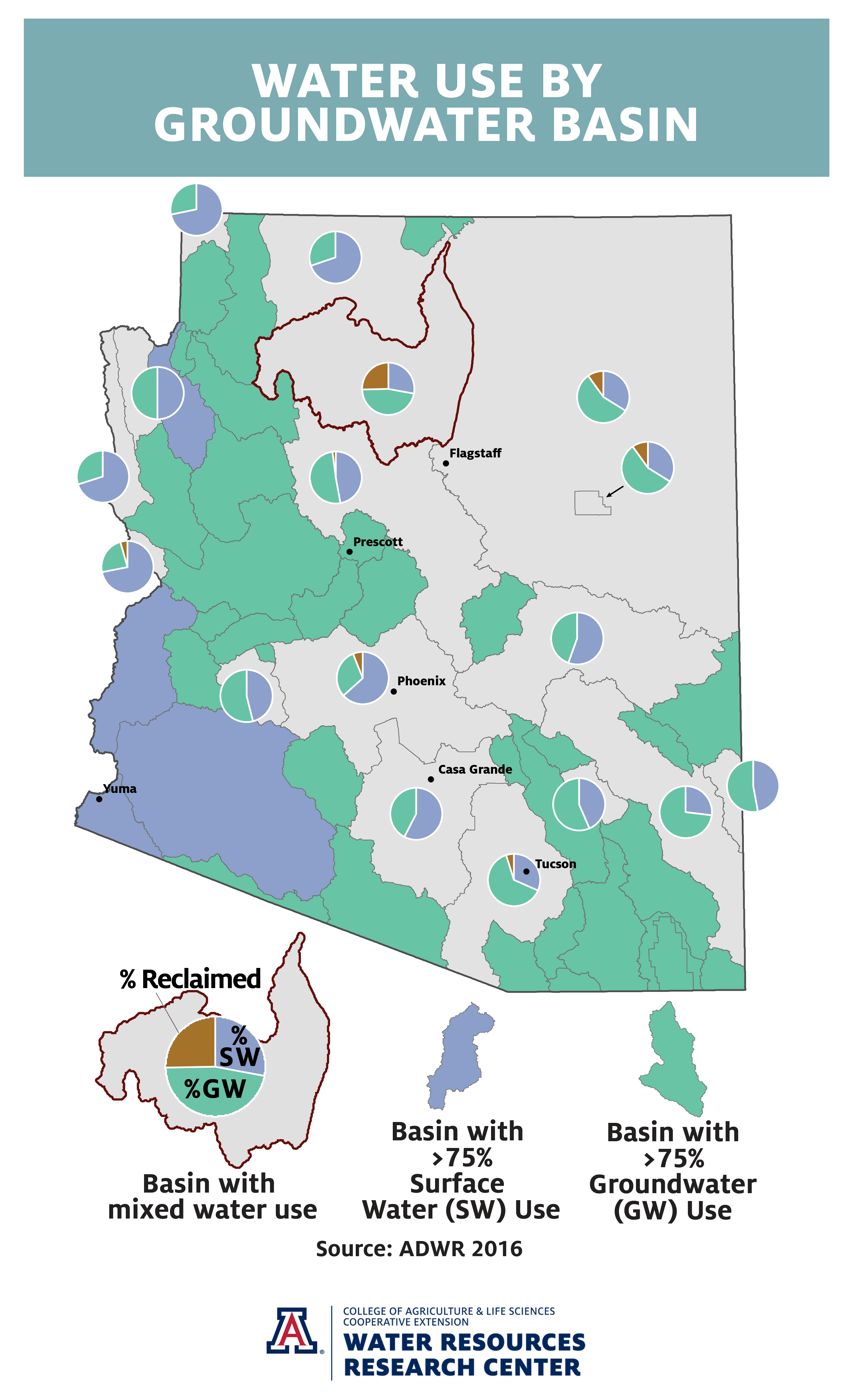
- Emphasis on groundwater usage
- Highlighted population density
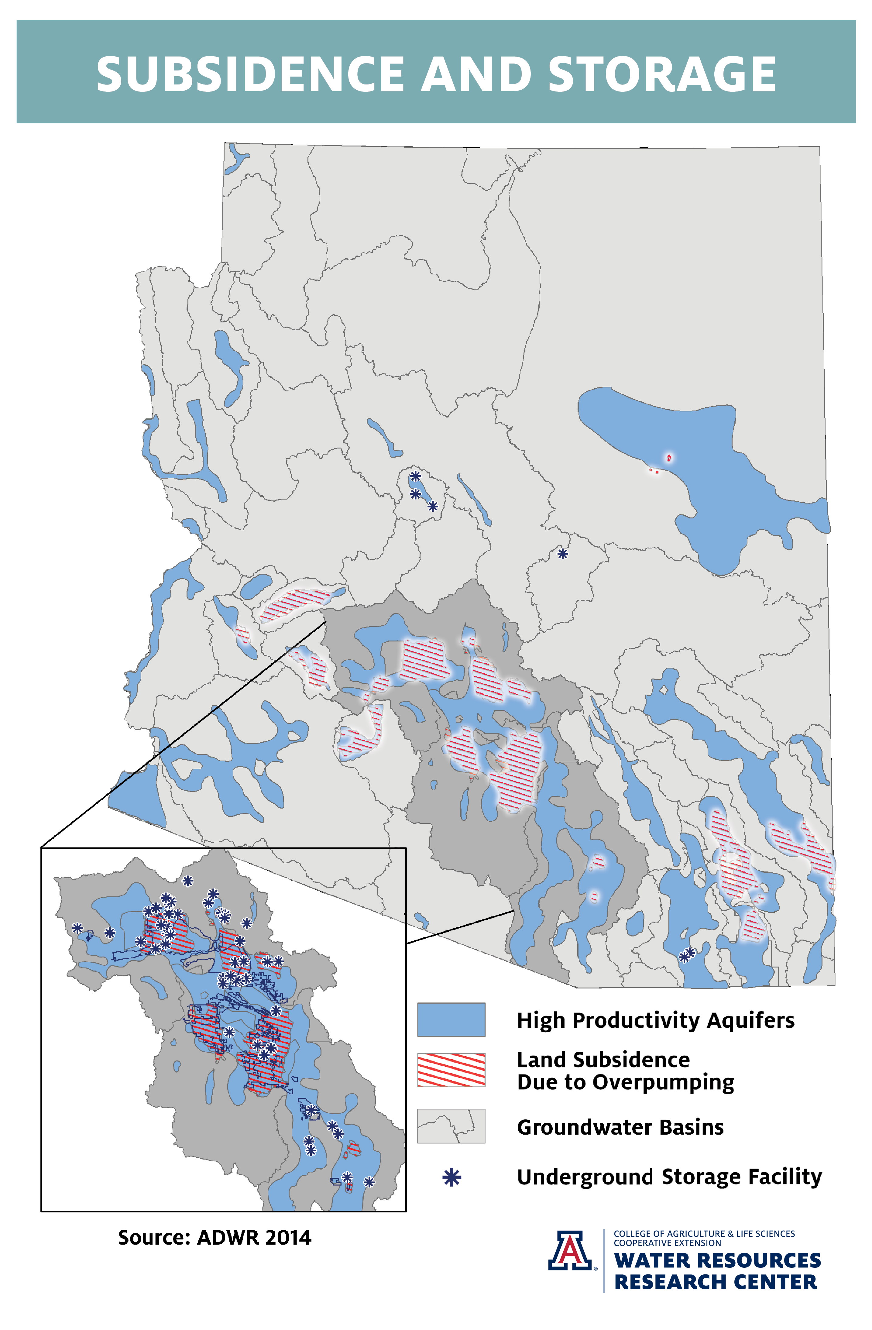
- New map on recharge and subsidence
- New natural terrain background using Esri’s multi-directional hillshade
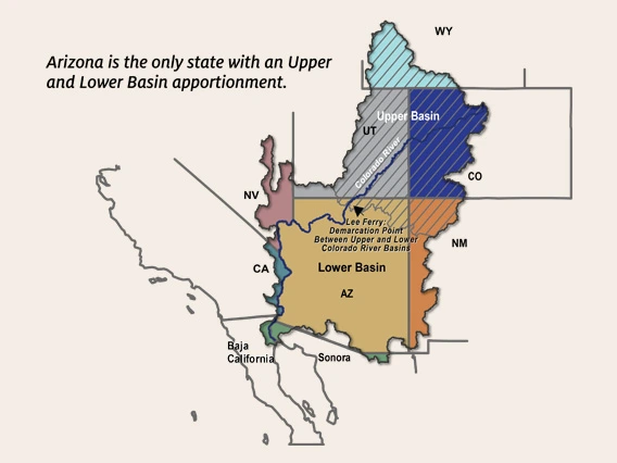
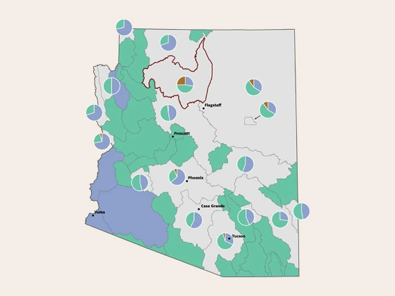
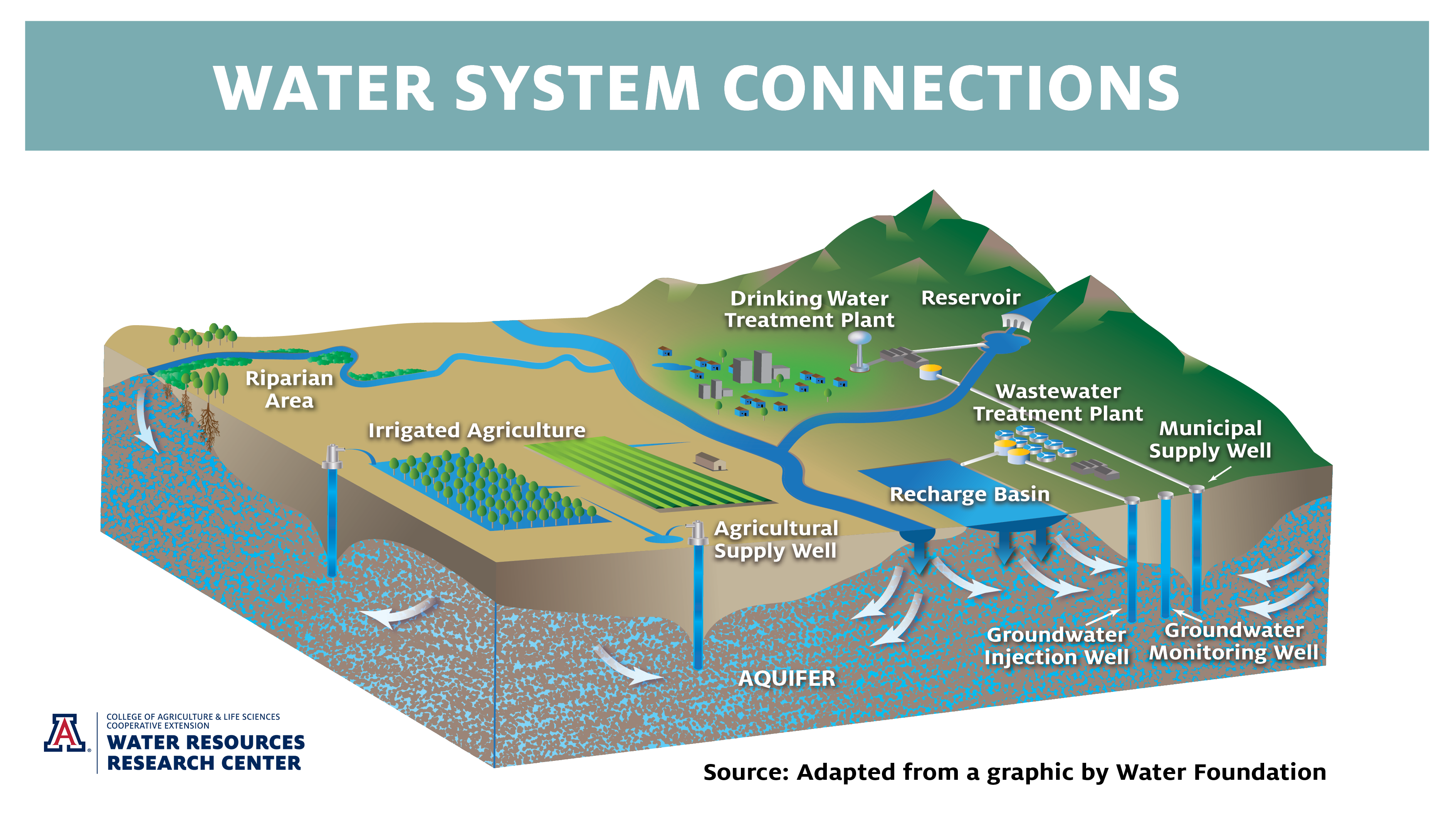
Map Insets
We thank our sponsors and partners for their support
Arizona Department of Water Resources, Arizona Municipal Water Users Association, Arizona Public Service, Arizona Project WET, Arizona Cooperative Extension, Central Arizona Project, EPCOR Water, Jacobs Engineering, Salt River Project, Sonoran Institute, The Nature Conservancy, U.S. Bureau of Reclamation, University of Arizona Research, Discovery & Innovation, and Water Resources Research Act §104(b) program.